
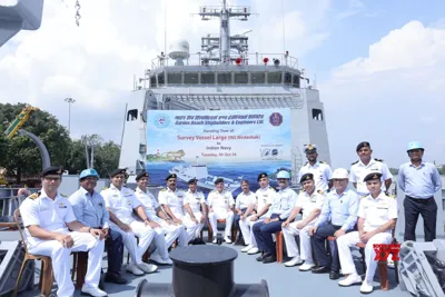
Indian Navy Receives Nirdeshak: Advanced Survey Vessel for Hydrographic Mapping
| Summary/Static | Details |
|---|---|
| Why in the news? | The Indian Navy has received its second large Survey Vessel, Nirdeshak (Yard 3026), for deep-water hydrographic mapping. |
| Shipyard | Garden Reach Shipbuilders & Engineers (GRSE), Kolkata |
| First Ship Commissioned | INS Sandhayak (03 Feb 2024) |
| Purpose | - Coastal and deep-water mapping- Port and harbor approach surveys- Determining navigational channels and routes- Collection of oceanographic and geophysical data for defense and civil applications |
| Ship Specifications | - Displacement: 3400 tons- Overall Length: 110 meters- Power: 2 diesel engines- Speed: 18+ knots |
| Hydrographic Equipment | - Autonomous underwater vehicle (AUV)- Remotely operated vehicle (ROV)- DGPS long-range positioning systems- Digital side-scan sonar |
| Key Features | - Designed per Indian Register of Shipping classification rules- Over 80% indigenous components- Supports 'Aatmanirbhar Bharat' initiative |
| Construction Timeline | - Keel Laid: 01 Dec 2020- Launched: 26 May 2022- Underwent rigorous trials before delivery |
| Applications | - Enhances defense operations- Civilian applications (coastal management, disaster preparedness)- Strengthens maritime interests in the Indian Ocean Region (IOR) |