
Kerala's Wayanad District to Get X-Band Radar for Disaster Preparedness
| Aspect | Details |
|---|---|
| Event | Devastating floods and landslides in Kerala's Wayanad district in July 2024 claimed over 200 lives. |
| Action Taken | Union Ministry of Earth Sciences approved the installation of an X-band radar to enhance disaster preparedness. |
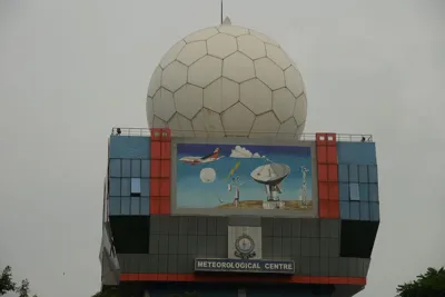
| Radar Functionality | Radar (Radio Detection and Ranging) uses radio waves to detect objects, measure distance, velocity, and characteristics. It employs the Doppler effect for analysis. |
| X-Band Radar Specifications | - Operates in 8-12 GHz range with wavelengths of 2-4 cm.- Provides higher-resolution images.- Detects smaller particles like rain droplets and fog. |
| Applications in Meteorology | - Monitors cloud movement, storm tracking, and rainfall intensity.- Tracks soil movements to predict landslides. |
| Limitations | Shorter range due to rapid attenuation of higher frequency radiation. |
| India's Radar Network | - Weather radars in use since the 1950s.- First indigenous X-band radar installed in New Delhi in 1970.- Expansion under 'Mission Mausam' includes 56 additional Doppler radars by 2026. |
| NISAR Project | Joint NASA-ISRO project to map Earth's landmasses using radar imaging.- Carries L-band (1.25 GHz) from NASA and S-band (3.2 GHz) from ISRO. |
| NISAR Launch | Scheduled for 2025 via ISRO's GSLV Mk II rocket.- Total cost of $1.5 billion, primarily funded by NASA. |